
Services
Monitoring Solutions
Real-Time Slope Monitoring
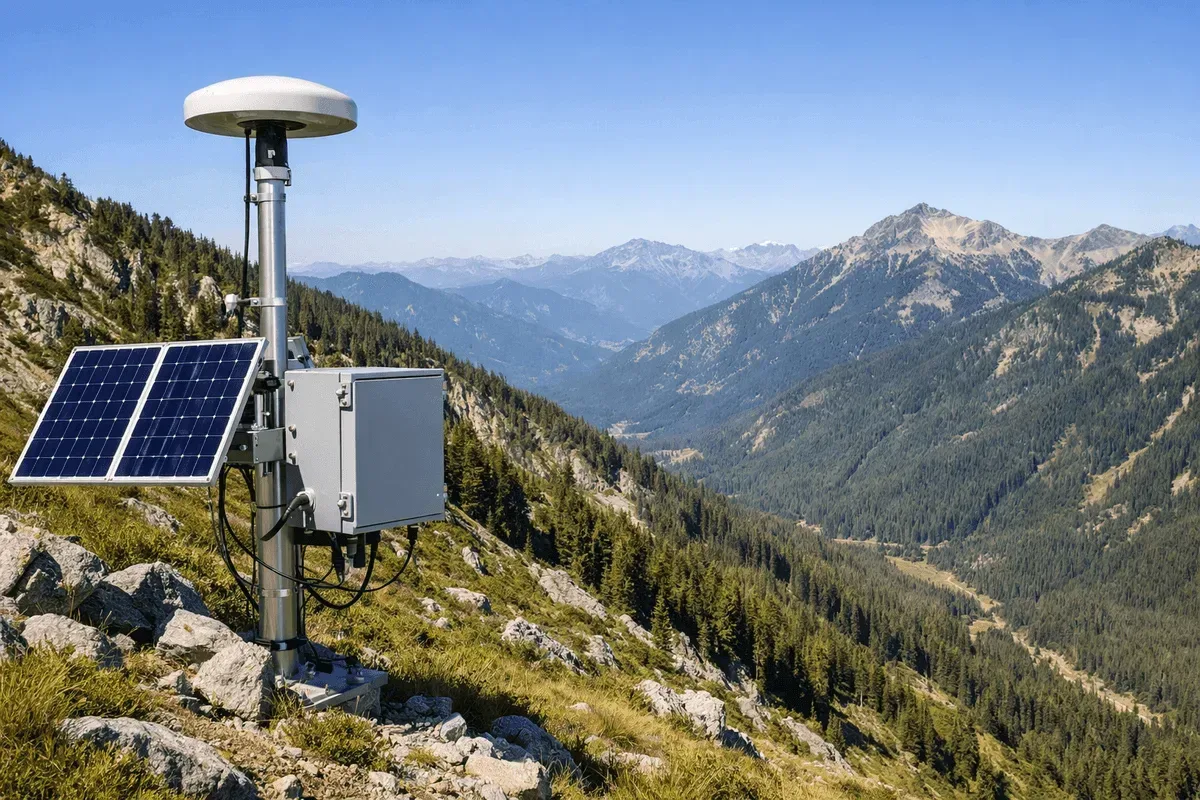
Real-time slope monitoring integrating GNSS, inclinometers, accelerometers and AI early warning: 3D surface displacement (1–2 cm horizontal, 2–3 cm vertical), deep displacement profiles, vibration and rainfall, streamed 24/7 to the GeoGuard platform with tiered alerts for road slopes and mountain settlements.
Landslide-Prone Area Monitoring
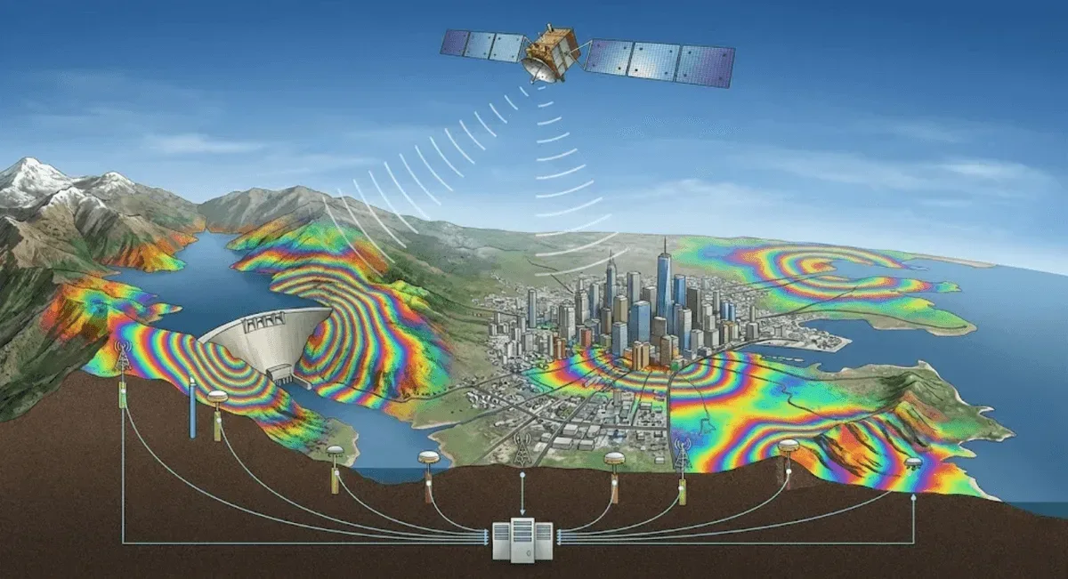
Large-scale collapse and landslide-prone area monitoring integrating InSAR satellite radar, GNSS and IoT corner reflectors: InSAR surveys wide-area deformation to identify active zones, then GNSS and corner reflectors track key locations long term, delivered as deformation-rate and hotspot maps.
Land Subsidence & Urban Settlement Monitoring
Land subsidence and urban settlement monitoring with InSAR (PS-InSAR / SBAS-InSAR): subsidence rate, cumulative settlement and differential settlement across hundreds of square kilometres with no on-site equipment, plus long-term trends from archive imagery. For levees, roads, bridge foundations and pipelines.
InSAR Satellite Radar Deformation Analysis
InSAR satellite radar deformation analysis combining DInSAR for rapid event assessment, PS-InSAR for per-point millimetre-level time series on buildings and rock, and SBAS-InSAR for vegetated terrain. Covers hundreds of square kilometres with no on-site equipment, delivered as deformation-rate maps and time series.
Bridge Structural Health Monitoring
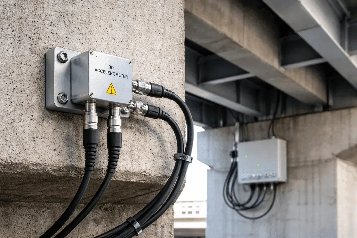
Bridge structural health monitoring integrating GNSS and accelerometers, tracking pier and deck 3D displacement, dynamic vibration and natural frequency 24/7. GNSS accuracy is 1–2 cm horizontal and 2–3 cm vertical, with data on the GeoGuard platform and threshold alerts. For highway, long-span and ageing bridges.
Dam & Reservoir Deformation Monitoring
Dam and reservoir deformation monitoring combining GNSS and InSAR: GNSS measures 3D displacement of the dam body (1–2 cm horizontal, 2–3 cm vertical) while InSAR captures millimetre-level relative deformation across the reservoir and surrounding slopes, overlaid with water level on the GeoGuard platform.
Retaining Wall & Slope Structure Monitoring
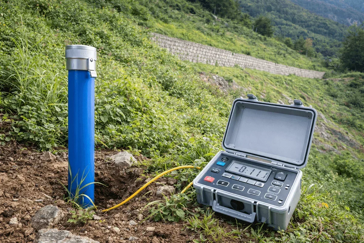
Retaining wall and slope structure monitoring with inclinometers and GNSS: inclinometers measure angle change in the wall plus multi-depth horizontal displacement profiles, while GNSS tracks 3D displacement at the wall top. Data reaches the GeoGuard platform with real-time alerts for deep excavation support.

Real-Time Landslide Early Warning System
Real-time landslide early warning combining on-site sensors — GNSS, inclinometers, accelerometers and rain gauges — with AI models. The GeoGuard platform analyses displacement rate, tilt, vibration and rainfall in real time, issues tiered alerts at threshold, and links to government alert sources.
3D Terrain Modeling & Mapping
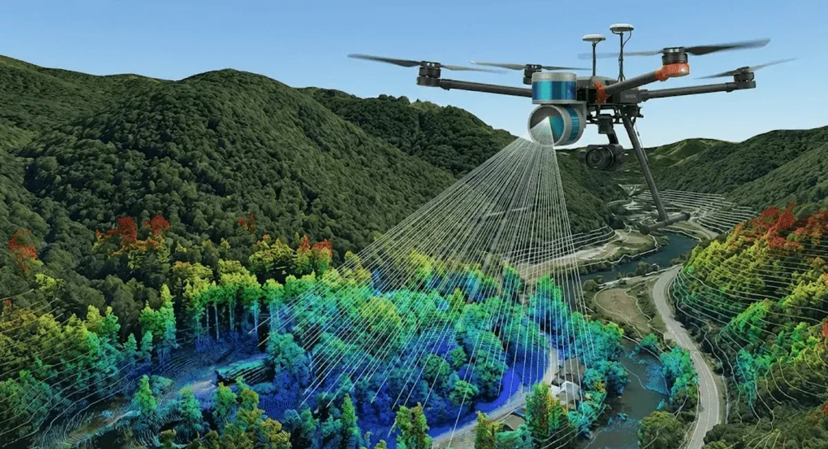
3D terrain modeling and mapping integrating UAV photogrammetry and LiDAR, producing high-density point clouds, DEM, DSM and orthophotos, extensible to contours, cross-sections and volume calculations. LiDAR reaches 2 cm accuracy; aerial survey reaches centimetre level with ground control points.
Forestry Survey & Forest Resource Mapping
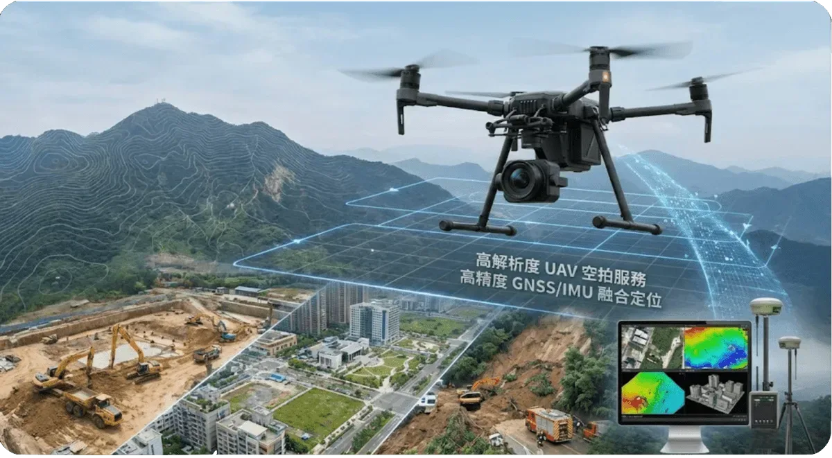
Forestry survey and forest resource mapping with UAV LiDAR: the laser penetrates the canopy to capture understory ground elevation (DEM) and canopy surface (DSM), producing canopy height models and tree height estimates. 2 cm scanning accuracy with standard GIS output, for resource inventory and watershed management.
Main Services
UAV Aerial Services
Professional drone aerial photography combining high-resolution image capture with image processing to deliver high-precision terrain data and monitoring solutions. For terrain mapping and 3D modeling, progress monitoring, environmental surveys and disaster assessment, centimetre-level with ground control.
UAV LiDAR Scanning Services
UAV LiDAR scanning for high-precision 3D spatial measurement, capturing high-density point clouds over complex terrain and large areas. Strong vegetation penetration, unaffected by lighting conditions, with 2 cm accuracy. For terrain measurement and digital terrain models, forestry survey and infrastructure scanning.
InSAR Deformation Monitoring
Satellite radar interferometry with three complementary techniques: DInSAR uses the phase difference between two acquisitions for rapid event-driven deformation assessment, PS-InSAR gives per-point millimetre-level time series on stable reflectors, and SBAS-InSAR mitigates decorrelation in vegetated terrain.
Equipment Maintenance
Complete lifecycle management for monitoring equipment: installation and initial setup, calibration and inspection, troubleshooting and repair, and system upgrades, keeping GNSS, accelerometer and inclinometer systems running reliably. Includes 24/7 technical support, scheduled maintenance and spare-parts management.
Geotechnical Monitoring Systems
Near Real-Time Differential GNSS Positioning (NRT DGNSS Positioning)
Near real-time differential GNSS positioning (NRT DGNSS): base-station corrections remove common errors and the monitoring station resolves carrier-phase RTK for centimeter-level 3D displacement. Unlike pseudorange-only differential positioning, it supports 24/7 monitoring of bridges, slopes, dams and subsidence.
Accelerometer Monitoring
Accelerometer monitoring of the dynamic response and vibration of structures: high-frequency sampling, multi-point synchronous measurement, micro-vibration detection and real-time alarms. For bridge health monitoring, building seismic response, machinery vibration diagnosis and environmental impact assessment.
Inclinometer Monitoring
Precision inclinometer monitoring of angle change, with multi-depth simultaneous measurement and deep horizontal displacement profiles, providing automated continuous tilt analysis for structures and strata. Suitable for slope sliding, deep excavation, building tilt and underground pipeline deformation monitoring.
AI Prediction System
Integrating multi-source monitoring data with AI and machine-learning algorithms for intelligent analysis, trend prediction and early warning — slope collapse warning, land subsidence trend prediction, structural deterioration assessment and anomaly alerts — with visualized decision support.
GeoGuard Data Platform
GeoGuard is RST Ltd.'s in-house monitoring data platform: it ingests GNSS, accelerometer and inclinometer data 24/7, flags quality issues, spikes and drift, summarizes displacement trends, and generates reports with an AI assistant. Rainfall overlays, government alerts and API integration included.
Frequently Asked Questions
What regions does RST Ltd. serve?
We primarily serve all of Taiwan, covering various engineering monitoring and geospatial information applications. For special requirements or international projects, please contact us and we will assess feasibility based on the project nature.
How can I get a service quotation from RST Ltd.?
Please contact us through the website contact form or call +886-4-26319908. Provide a project overview and requirements description, and our engineering team will respond promptly with a detailed service proposal and quotation.
What types of services does RST Ltd. provide?
We provide comprehensive monitoring and geospatial information services, including UAV aerial survey, LiDAR scanning, 3D modeling, InSAR satellite radar deformation monitoring (DInSAR / PS-InSAR / SBAS-InSAR), GNSS positioning, accelerometer and inclinometer monitoring, AI intelligent prediction, GeoGuard data platform, and equipment maintenance services.