DInSAR Deformation Monitoring
Services
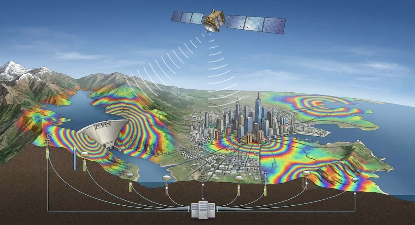
Service Content
Utilizing satellite DInSAR (Differential Interferometric Synthetic Aperture Radar) technology, we provide large-scale, long-term ground deformation monitoring services.
Main Applications
- Land subsidence monitoring
- Slope stability assessment
- Deformation analysis around mining areas and reservoirs
- Earthquake and volcanic activity monitoring
Technical Advantages
- Large-scale synchronous monitoring
- Millimeter-level precision
- Unaffected by weather conditions
- Historical data retrospective analysis
Frequently Asked Questions
What is the detection accuracy of DInSAR monitoring?
Our DInSAR technology (including SBAS and PS-InSAR analysis methods) achieves millimeter-level surface deformation detection capability while covering hundreds of square kilometers, making it ideal for large-scale ground deformation monitoring.
Does DInSAR monitoring require on-site equipment installation?
No. DInSAR is a remote monitoring technology that analyzes satellite radar imagery. No on-site equipment installation is needed. With satellite radar imagery data of the target area, long-term and wide-area displacement monitoring and analysis can be performed.
Can DInSAR results be integrated with other monitoring data?
Yes. We regularly integrate DInSAR results with GNSS, inclinometer, and other on-site monitoring data. Cross-referencing multiple data sources provides higher-confidence displacement trend assessment and engineering safety recommendations.